


Howard Precinct 04-001, Howard County, Maryland
About
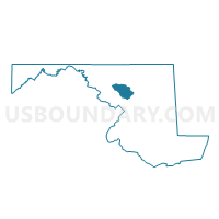
Outline

Summary
| Unique Area Identifier | 592578 |
| Name | Howard Precinct 04-001 |
| County | Howard County |
| State | Maryland |
| Area (square miles) | 12.99 |
| Land Area (square miles) | 12.97 |
| Water Area (square miles) | 0.02 |
| % of Land Area | 99.87 |
| % of Water Area | 0.13 |
| Latitude of the Internal Point | 39.33147160 |
| Longtitude of the Internal Point | -77.13796180 |
Maps


Graphs
Select a template below for downloading or customizing gragh for Howard Precinct 04-001, Howard County, Maryland


Neighbors
Neighoring Voting District (by Name) Neighboring Voting District on the Map
- Carroll Precinct 13-002, Carroll County, MD
- Frederick Precinct 18-001, Frederick County, MD
- Howard Precinct 04-003, Howard County, MD
- Howard Precinct 04-005, Howard County, MD
- Montgomery Precinct 01-001, Montgomery County, MD
- Montgomery Precinct 12-001, Montgomery County, MD
- Montgomery Precinct 12-002, Montgomery County, MD
Top 10 Neighboring County Subdivision (by Population) Neighboring County Subdivision on the Map
- District 1, Montgomery County, MD (22,072)
- District 12, Montgomery County, MD (19,949)
- District 4, Lisbon, Howard County, MD (13,899)
- District 13, Mount Airy, Carroll County, MD (9,978)
- District 18, Woodville, Frederick County, MD (9,628)
Top 10 Neighboring Unified School District (by Population) Neighboring Unified School District on the Map
- Montgomery County Public Schools, MD (971,777)
- Howard County Public Schools, MD (287,085)
- Frederick County Public Schools, MD (233,385)
- Carroll County Public Schools, MD (167,134)
Top 10 Neighboring State Legislative District Lower Chamber (by Population) Neighboring State Legislative District Lower Chamber on the Map
- State Legislative District 14, MD (120,883)
- State Legislative Subdistrict 9A, MD (95,947)
- State Legislative Subdistrict 4B, MD (43,943)
Top 10 Neighboring State Legislative District Upper Chamber (by Population) Neighboring State Legislative District Upper Chamber on the Map
- State Senate District 9, MD (138,809)
- State Senate District 4, MD (125,297)
- State Senate District 14, MD (120,883)
Top 10 Neighboring 111th Congressional District (by Population) Neighboring 111th Congressional District on the Map
- Congressional District 6, MD (738,943)
- Congressional District 4, MD (714,316)
- Congressional District 7, MD (659,776)
Top 10 Neighboring Census Tract (by Population) Neighboring Census Tract on the Map
- Census Tract 6040.02, Howard County, MD (7,624)
- Census Tract 7519.03, Frederick County, MD (6,362)
- Census Tract 6040.01, Howard County, MD (6,275)
- Census Tract 7001.03, Montgomery County, MD (5,864)
- Census Tract 5130.02, Carroll County, MD (5,277)
- Census Tract 7002.04, Montgomery County, MD (2,124)